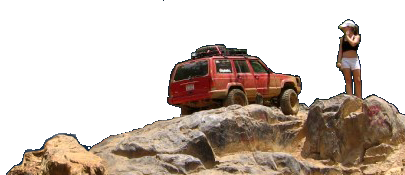
Rausch Creek

Sounds good.

I heard y'all will leave NC on Friday, about what time do you think you'll arrive? If its early enough we might be able to get in a couple trails on Friday. The do not allow night wheeling there unfortunately.
 
Good to hear. Randal and I will leaving from simmons truck stop at 9am on june 4th if anyone wants to convoy. Simmons truck stop is on 85 just inside Va.
 
If you guys are going straight to the park to camp, exit 104 is closed for maintenance so you'll want to go up to exit 107 and come in from the other direction. Google maps knows Rausch Creek Offroad park so you can easily find it there.
 
So I was on my way to NY today and decided to stop by Rausch Creek to see exactly where it is. At least for today, Exit 104 is open but it has some major potholes.
When your GPS takes you to 453 Molley town rd, you will come to a private drive with a sign that tells you to continue 1/2 mile.
20150520_092512.jpg
 
I only pulled into the parking lot, there was no one there. There's a small truck stop and tire place when you get off at exit 104, but not much else. If you need groceries or anything else you better hit exit 100 or bring it with you.
 
There is a small town between exit 100 and 104. If you go to the end of the road past the truck stop and make a right you'll see the town. There are a couple restaurants and what not.

If you do goto a restaurant they claim they have sweet tea, however it is not sweet tea its something terrible.
 
Use exit 107 and make a right and follow that into town... There's no mega hill to climb but there are also no amenities...
 
Go to Google Play Store and download maplets for 2.99... When you get there download nearby maplets and there will be 3 maps for Rausch showing you exactly where you are with a GPS dot
 
Maplets works for URE as well as almost any close by hiking biking horse riding trails --will show up dependent upon your location when you search...
 
So i contacted the park and told them I was coming on Thursday, they told me to go to the right when I enter the park and go to camp C. It sounded like there would be room for others there too, but I did not know if anyone else had contacted them yet.

I'm still undecided on which way I will take to get there. Going straight up 29 to 64 to 81 is definitely shorter but mostly mountains. 85 and up through DC is much flatter, but it goes through DC.
 
We are further east but are planning to go 85 through DC. There is a bypass route you can take in Fredericksburg, I think its 17, that adds about 20 minutes to the trip but with it being a Thursday and a non-holiday weekend, I don't expect much trouble. Of course that will all depend on what time you guys come through there.
 
Most likely I will be meeting up with y'all at the truck stop, but it kinda depends on what time I get off work the night before.
 
Work & personal issues are once again preventing me from making this months ride. Have fun, be safe, take lots of pictures.
 
I will try to be at the truck stop, but I may not get off work until one. If that's the case I won't be there.
If I am there I will be in a blue chevrolet dually with a truck camper and black Cherokee in tow.
 
There no longer is an additional fee for the Northeast property.
Try devil's den and upper/lower talisman...
 
I also found a nice, close restaurant nearby when I was there last weekend... Breakfast lunch and dinner~~ Behm's in Tremont, about 4 miles....dinner= $10.95
 
Back
Top