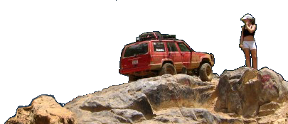
Mountain City, TN <--- Saturday 9/1 Anyone?

uncc civilengineer

Well-Known Member
Joined
Jun 28, 2006
Location
Pfafftown, NC
My cousin and myself are going to head up that way Saturday morning and wanted to see if anyone else would like to go?

We've never been there so someone w/ trail experience would be cool w/ us...
 
good luck, if you can't find anyone from here i would highly reccomend trying to hook up with someone in the campsite/parking area that's familiar with things. the map is useless and the trails are poorly marked.

i took a wrong turn/got lost a couple of weeks ago and ended up on the east side of mountain city just off 421. sad thing is that was my 5th or 6th time going there.
 
FYI...Descent Map here:rolleyes:


Cool where is it and how hard is this place. Never heard much about it. Or is it one of the places where we can ride in 2x4. I may be interested in going. I am from Asheville, pm me ith a phone number and I will call you.
 
Cool where is it and how hard is this place. Never heard much about it. Or is it one of the places where we can ride in 2x4. I may be interested in going. I am from Asheville, pm me ith a phone number and I will call you.
No deffinately not a place to drive in 2WD. See the link below for pictures from my first outing there a couple a weeks ago with some friends.
Photobucket
 
I have the map from Ol' Jeeps... but can someone post some directions up..

We'll be coming up 421 W towards Boone..

Also, what trails do you recommend we run (do the colors mean anything on the map?)

Thanks
Chris
 
Stay on 421 through downtown boone and follow it out toward Tennessee. 321/421 fork about 4 miles out of town, stay right on 421 and follow it until you come into Mountain City. Make a right at the light after the BurgerKing/Gas Station and stay on that road for about 3 miles until you see the sign on the right for Callalantee. Right at the sign and then right at the next sign which is the campgroud/ trailhead.

Trails: Welder (Obstacles on Welder: Waterfall, Easy Out, The Step) Blue, Little Tellico, Yellow to Tower/Upper Rock Garden.
 
Run all of Welder and its offshoots, and try to swing by the Yellow Rockgarden and the Tower for eating lunch. If you hate your truck, try Pull Cable and the AORC Rocks.
 
heading to beach tomorrow or I would go. Been wanting to do a trip lately. Maybe next go around.
 
What time are you all leaving? I have been wanting to head up there as well. May be able to meet you in Boone if things work out.
Steve
 
... (do the colors mean anything on the map?)...

Colors are only from the original map. If you are really lookin, you can find an occasional trail (color) marker out there!

I have box of about 100+, 2 1/2" round steel slugs I would like to donate/help paint/join a "trail marking" outing.
 
Are you guys going to happen to be there on Sunday? Since its a long weekend. I would like to go but cannot make it on Saturday. If you can be there on Sunday pm me and leave me a phone number and I will call and set it up. Thanks guys.
 
What time are you all leaving? I have been wanting to head up there as well. May be able to meet you in Boone if things work out.
Steve

Steve, we're planning on leaving out of Lewisville around 6:30-7.. so we'll be up in boone between 7:30 and 8..

If you interested let me know or PM me your number.

Chris

Coker, sorry man but I have to get back into town by Sunday we're in the process or moving.
 
i might be heading up there sunday or maybe monday. i would like to test my diesel swap.
 
PM sent. Meet you guys in Boone at 8:00am-ish.

Steve
 
Back
Top