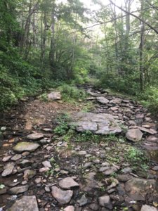
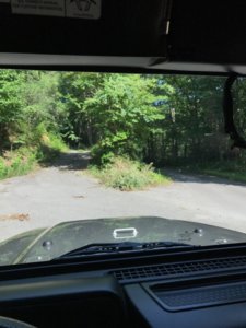
The old Tellico revisited...... Picture heavy!

I think we should all make the trip to durhamtown tellico this yr to let them know we want the place to develop more. Myself and others had a trip planned but things happened that kept us from going. All I hear about the place is there's not much there obstacle wise, well there won't be if no one goes. And for all that used to wheel Tellico you know you could ride most of the place in 2wd until you got to one of the obstacles, of which you could count on both hands.

Agreed. I also went by there too. I'm obviously a huge NAXJA guy and we are planning a ride there this year. I'd love to know if any of you guys go there this year so I can try and make it. The lady there said they were about to open some new trails too. Thanks for the kind comments guys. I wasn't sure how it would be received. I am planning a second hike when it's warmer to try and get to Fains Ford and maybe slickrock.
 
Just sickening that it got shut down to be logged and developed. I think TU got more than they bargained for with that fight. Maybe they were just an easy excuse for a developer to ride.
 
Don't know if it's the same night or not, but I recollect an evening when Dylan & Hundley were cooking/reheating BBQ by a small stream that was full of bear tracks. I seem to remember them being in a "far away" different location next morning. :lol:

Ranger Rick had stopped by and once again ripped us a new a-hole about not having food in bear proof containers. He was not amused when I said this bbq was going to end up in my belly. We were warned of a ticket if we didn't either eat all the food,(including a 12 pack of burger buns) or find a place to store it. Inside the jeep was a no go(the ranger actually grabbed my soft door and damn near pulled it open) stating how easy it would be for a bear to rip it off.

Again he was not amused when I said it would be better to rip the jeep door off than my belly.

If I remember correctly, we decided to just move to a less ranger populated area, because he was determined to catch us storing our food in the jeep and set an example.
 
I can remember one trip...

We were riding past the guardrail/fence, leaning hard passenger side, and it was snowing so hard that my drivers side window was covered in snow and I couldn't see out of the left side at all. I mean, snowing like a blizzard.

Cut to several hours later...we are all back at the campground(state Line iirc) and it was so hot, we were in shorts and tee shirts. Might have been John Brooks, Hundly, Aaron..i cant remember, but they tossed/threw a big cup of cold water on my back. Ended up hanging my shirt on the jeep to dry. Shirtless and in shorts...still warm as could be. All the while, just on the other side of the mountain...Blizzard.
 
If we are going down memory lane........Our group just got to slick rock on a nice sunny day at about 4 o'clock. Out of nowhere comes a monster rain storm and it poured for 45 minutes straight then just stopped. Well it took our group 6 hours to get up the short trail because now it was slick as all get out (basically a winch fest) and another 2 hours to get back to murphy. Thank goodness the waffle king was still open for a very late supper.
 
Not really to do with the actual riding at Tellico...just the trip up there which can be just as much the adventure. You should try enduring 6 hours of driving with Dylan in the other vehicle rapping Eminem over the CB the entire trip. I never knew he was a closet rapper till that trip. Still not sure why I didn't turn off the CB?

The last trip I made was the last Dixie Run that was there. That trip home ended up taking about 9 hours due to some bad fuel in Bentley's tow rig which ended with a low boy tractor trailer picking him and gooseneck up on the side of the interstate on the other side of Morganton. That made for a neat pic...wish I still had it.
 
I remember a trip with the dump trucks and a case of eggs and then someone getting a helicopter ride and before the ride taking a bath in the freezing creek water hahaha
 
Sort of an update sort of a WTF!!! Remember the gates they locked. Got a report last week they were open again. i talked with someone that has been riding up there and it appears they are opening the gates again.
 

Attachments

  • 619940A4-D61C-4723-86AA-4AF9408F5B06.jpeg
    619940A4-D61C-4723-86AA-4AF9408F5B06.jpeg
    273.8 KB · Views: 280
  • 53AD3BD7-BC44-4F12-B8BC-4312E992FF78.jpeg
    53AD3BD7-BC44-4F12-B8BC-4312E992FF78.jpeg
    129.5 KB · Views: 294
Sort of an update sort of a WTF!!! Remember the gates they locked. Got a report last week they were open again. i talked with someone that has been riding up there and it appears they are opening the gates again.
Opening the gates to the trails!?
 
Sounds like a trap. No way the government would let you do something for free that they used to charge for.
 
Im sorry officer, my gps sent me this way
 
Opening the gates to the trails!?

Yea the old trails.

Should this be hush? No?

Sent from my iPhone using Tapatalk

Why Hush? If they are open no reason to keep it hush.

Sounds like a trap. No way the government would let you do something for free that they used to charge for.

I dont think so. The old trails are covered in. So far the person I talked to that went in the old trail 6 entrance says he is not sure if its the same and has seen some cabins back in there. It's not like the trails are open. He went in trail 5 and supposedly you can get to the bridge now. Maybe they are opening them for access to the land for hunters and fishers. IDK Just thought I'd update this thread with what has been brought to my attention.
 
It's legally seasonally opened. They bush hogged the gravel road leading to the trail last week. The trail is fairly tight and over grown. There's more than 2.2 miles back there.
View attachment 274105

The attachment is dated Oct 2009. Last time I rode before closure was 2009ish. I am slightly confused by this -- It looks like slickrock, helicopter pad, schoolbus are still closed if I am recalling my trail numbers right. Which major obstacles remain (or where am I wrong)?
 
The attachment is dated Oct 2009. Last time I rode before closure was 2009ish. I am slightly confused by this -- It looks like slickrock, helicopter pad, schoolbus are still closed if I am recalling my trail numbers right. Which major obstacles remain (or where am I wrong)?
Yes the closed them. You are reading it right. Technically these are FS roads I guess.
 
The pic is part of the 255pg. Trail assement from '09. Alternative C is what was choosen in court. I've posted the attachment that details what alternative C concludes. To make this clear, T4, T5 and T6 are the only legal seasonally open trails. Upon shutting down the trails were rehabilitated and all bridges/ pressure treated lumber removed. T4 I have not personally been on. T5 is nothing more than a gravel road that dead ends after a mile. T6 is gravel road for nearly 2 miles. Then there's a gate that's open and is a trail. Between easy and difficult the climbs are easy/medium. I have not found anything difficult. T6 is nothing like it was. It is in fact tight and narrow/ over grown. Someone has done a lot of cutting back there. There are several trails that branch off 6 but are greatly over grown. I did in fact find a cabin and other remains back there.
IMG_7845.JPG
IMG_7846.JPG
IMG_7849.JPG
IMG_7850.JPG
IMG_7851.JPG
IMG_7702.jpg
 
The pic is part of the 255pg. Trail assement from '09. Alternative C is what was choosen in court. I've posted the attachment that details what alternative C concludes. To make this clear, T4, T5 and T6 are the only legal seasonally open trails. Upon shutting down the trails were rehabilitated and all bridges/ pressure treated lumber removed. T4 I have not personally been on. T5 is nothing more than a gravel road that dead ends after a mile. T6 is gravel road for nearly 2 miles. Then there's a gate that's open and is a trail. Between easy and difficult the climbs are easy/medium. I have not found anything difficult. T6 is nothing like it was. It is in fact tight and narrow/ over grown. Someone has done a lot of cutting back there. There are several trails that branch off 6 but are greatly over grown. I did in fact find a cabin and other remains back there. View attachment 274107 View attachment 274108 View attachment 274109 View attachment 274110 View attachment 274111 View attachment 274113

Are you riding these in a vehicle or on a bike?
 
Why Hush? If they are open no reason to keep it hush.

I figured the off-road community would be scrutinized again if a convoy of jeeps showed up even if the gates were open (if that even were to happen). Richland Rd would be my example. IDK just saying what first came to my head.
 
Seems like somebody should just talk to the local ranger, to get the scoop on the up and up.
 
I rode through there today. Was in the area for work so took a detour. Gates were indeed open, but only so many places I would take a crew cab truck by myself with no winch, and without knowing where I was even supposed to be. Trail 5 and 6 main gates were definitely intentionally opened. Swung out with both locks intact on the mechanism where they had been unlocked, opened, and then locked back. There was. White/grey gate a few miles in on 6. I went just last to a space big enough to turn around and walked in. The trail was pretty overgrown. Trail 5 went open just past the bridge to the camping area and then ended. Didn’t see anywhere to access 4 as the gate was closed.

The whole area was super overgrown. Looked the set of an apocalypse movie.

Very curious as to the legality/status. At this point it was just be nice to have somewhere to camp and explore.

Old parking lot
b6fa32e101c9fd939c60ad38912f8be6.jpg


Trail 4 gate
a5000f0744b38589273cd8f7169c6e5e.jpg


Tenn side pay station area
9f2a505cc28aab7c9a7719d65f31cbd2.jpg


Trail 6 Bridge
b377d92af7dccbfd9b181488b2ceb30d.jpg


Trail 6 after the 2nd gate
e96cb18f1a1e79a3aa5b15f6508dbe44.jpg
 
Back
Top