getstucksome
Well-Known Member
- Joined
- Nov 7, 2005
- Location
- Charlotte/Mt. Holly area
looks great, thanks for your hard work and time spent keeping the trails open and maintained!
You will be ok on the Yellow Trails on the map and most of the Blue trails, But there are spots on the Blue that are rough.

When did RML become "difficult"?
I haven't been there in awhile now, but isn't the only real problem the ledge area before Kodak?
It gotten pretty rough is several spots before the ledge.
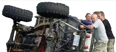
Here is one spot before the ledge,
Sorry for the Hijack guys
And you took the sally line LOL

Isnt that the ledge?It gotten pretty rough is several spots before the ledge.
Here is one spot before the ledge,
Sorry for the Hijack guys
Isnt that the ledge?
Isnt that the ledge?
That's exactly what I thought, somewhere I have a pic of the $30XJ nosediving into that rock at 30 mph lol.

great job looks cool.. hay whats a good trail for a mostly stock xj
that ledge has grown quite a bit recently, I bet 4x the hegiht it was when the $30XJ blazed thru. Actually, it was just a medium-sized gulley where water ran between the 2 rocks, now its a full-fledged wallThat's exactly what I thought, somewhere I have a pic of the $30XJ nosediving into that rock at 30 mph lol.
Glad you guys fixed that! We were eyeballing it on the NC Trail Cleanup Day. We contemplated trying to do a temporary fix, but without equipment it was too much to handle. We did put your trail sponsor sign back up that someone ran over!
that ledge has grown quite a bit recently, I bet 4x the hegiht it was when the $30XJ blazed thru. Actually, it was just a medium-sized gulley where water ran between the 2 rocks, now its a full-fledged wall
fixed what..the ledge on RML?
Still hyjacking, the ledge wass actually harder than Kodak last Nov.
We got all the bridges repaired. It was a looong day. Its easier to fix them in the off season, because otherwise you get too many yahoos trying to cross and get around you while your doing repaires when the trails are open..yeah I was gonna ask ya Tom, because those bridges were out long time ago.... Does the FS restrict when repairs can happen?
Like in the off season only?
[hijack]And yeah thats the ledge. Check out the race video on Youtube and see how diff it was then and now. It still is nasty just depends on your line. I can do it and I aint locked up front. [/hijack]

Any one know how that rough section of falls dam is? From my memory it between the big mud pit and the two somewhat deep water holes. If you come the direction from 553 it makes you climb a rocky ledge after a turn. It is getting more dug out every year and looks like it is starting to get fun. How about any updates on other major obstacles? I heard they are even touching the upper part of RML and almost all of Daniel. Should be fun!
Any one know how that rough section of falls dam is? From my memory its between the big mud pit and the two somewhat deep water holes. If you come the direction from 553 it makes you climb a rocky ledge after a turn. It is getting more dug out every year and looks like it is starting to get fun. How about any updates on other major obstacles? I heard they aren't even touching the upper part of RML and almost all of Daniel. Should be fun!


