Important section...
Trails – Existing Conditions
There are 121 miles of designated system trails on the Uwharrie National Forest. Of this
total, 16 miles are designated as OHV routes, 40 miles are designated as equestrian trails,
17 miles are designated as bike trails, and 48 miles are designated as hiker-only trails.
All these uses have become increasingly popular on the Uwharrie - especially equestrian
and OHV use because of limited opportunities elsewhere in the central portion of North
Carolina. The Uwharrie National Recreation Trail follows a north-south route through
the Forest. It is the focus of several conservancy organizations that hope to protect the
entire length of the trail and put as much of the route as possible on public land. At
present, only about 50% of the desired route is on public land.
PRELIMINARY DRAFT PLAN FOR COMMENT MARCH 2010
GOALS/DESIRED CONDITIONS 18
With the increasingly heavy use, many trails of all types are in need of heavy
maintenance, reconstruction, or relocation. Trails that might have sustained the lower
levels of use that existed when they were established are unable to sustain today’s higher
levels of use. The Forest Service has received very limited trail maintenance and
management funding for the Uwharrie in recent years; however, dedicated trail
volunteers have donated hundreds of hours of time to trail maintenance and have
improved conditions in many locations. Over time, additional trails may be built as
conditions of the existing trail system improve.
Trail-Related Goals/Desired Conditions
TRL-1. Exceptional trails are available for hikers, horseback riders, off-roaders,
mountain bikers, hunters, and anglers. The trails are designed, constructed,
and maintained so that a variety of levels of challenge is available and
minimal damage occurs to other forest resources such as soil and water.
TRL-2. The trail system has trails of varied lengths, including loop trails and trails
with multiple access points, and may connect with trails on other
ownerships. Trail users are well-informed about the trails and about ways to
minimize their impacts on the environment during their visits. Many trails
have vistas – points along the trails that allow for long-range views.
TRL-3. Trails are safe and safe vehicle parking is nearby. Trails and trailheads are
well marked and easy to find; trails that cross roads are well marked for
safety at all intersections. There are few hazard trees. For added safety, horse
use and OHV use occur on separate trails.
TRL-4. Recreation use is dispersed across the Forest and there is good trail access
for visitors to both northern and southern portions of the Forest.
TRL-5. The 50-mile Uwharrie National Recreation Trail is complete and marked for
hikers. That portion on National Forest System lands has high scenic
integrity.
TRL-6. Mountain biking occurs only on roads and designated trails in several parts
of the Forest.
TRL-7. Horseback riding occurs only on a designated trail system. Riders are
informed about how to ride safely. Horse trails are well designed and
maintained to provide varied user experiences (easy to more difficult) while
minimizing resource damage. Trails do not coincide with roads and trails
will cross roads at designated locations. While trails avoid wet areas, access
is available to horse watering areas. While on the horse trails, visitors
seldom see evidence of litter or erosion and sediment transport into streams.
PRELIMINARY DRAFT PLAN FOR COMMENT MARCH 2010
GOALS/DESIRED CONDITIONS 19
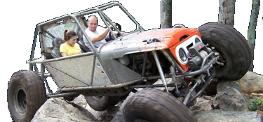
TRL-8. An OHV trail system exists that is well designed and maintained to provide
varied user experiences (easy to more difficult) while minimizing resource
damage. Designated OHV routes are clearly defined on maps and on the
ground, and off-highway vehicles are operating only on designated routes
during the established open season. Little sediment can be seen entering
streams from the OHV system, and trails are free of litter.
TRL-9. Well-trained partners and volunteer groups are working to maintain or
improve the trail systems.


