Uwharrie Trail Map - 2010 Update, Need your Input!

I agree with Ratty on the trail difficulty ratings. I like your idea of "Stock Vehicle on Street Tires" or "38"+ Tires & Two Lockers - Expect Body Damage" as ways of rating trail difficulty. Would make it more useful to a Uwharrie newb.

i think simply making the terms relative, like:
Most difficilut
Difficult
mModerate
Easier
Easiest

etc
would be fine, then somewhere above or below simply add line "Based on stock vehicle". I wouldn't even bother w/ "street tires", as that adds more things to question or wonder about.
Looks like that's pretty close to how it was in the first post....
 
one thing im confused on is Kodak rock the rock garden or the 5 foot high triangle shaped rock that every on drives their front tires on :confused:


one thing that has been of issue lately with a few people - is which rock is kodak rock.
Everything I have been told by people that go a lot is that the rock that everyone 'poses' on is called poser rock on Slab pile.

When you go up RML, you hit the ledge then go into the rocky area people call the garden now. It didn't used to be that way, used to be a little narrower. But anyhow.
The first set of rocks that has a name there is Budweiser and then the top one is Kodak. The people that I have wheeled with that know URE never have called the rock on Slab pile 'kodak rock'.
I have heard others say that the big rock on SP is kodak but I really would argue its NOT for a lot of good reasons. anyhow...

this is Kodak:
alh6.ggpht.com__TQrq1VUJHDA_SqUZKdSLv_I_AAAAAAAAHPI_gAbSqNslWco_s288_DSC02754.JPG
 
Thank you! that clears it up a lot. that has always been confusing for me.

i found a picture:
so this is poser rock?:

picture.php
 
^^ wow.
His wheelbase is perfect for it, any longer and it would have hung up going over and leveling back out.
 
Whats the hill climb on dutch john look like now? It was getting kinda nasty. I was thinking of taking the wifes libby out for some trail riding.
 
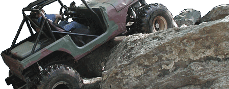
I didn't get to see it on the work day, but unless they filled in the rut on the right hand side of the hill climb I wouldn't do it in a stock Liberty. But that is just me. I mean it could be doable in a stock Liberty, its just don't be surprised if you end up against the wall where the rut is.

I took the advice given to me on the map and updated a few things, plus some things that changed via the work day etc:

badinlaketrailmaprevise.jpg


- Increased the Size of the Borders on the trail information blocks

- Changed "Extremely Difficult" and "Easy" to reflect a "Easiest" to "Most Difficult" rating system. Also put ("Based on a stock vehicle") back on the bottom.

- Removed a bypass on Falls Dam (we put up guard rail), and added a couple bypasses on Dickey Bell.

- Add more specifics to the Obstacles of Interest including more up to date names. For example on Falls Dam for a long time now the "Mud Pits" have had their own names. So I put the "Soup Bowl" and the "Ledges Mud Pit" to replace the generic "Mud Pits". Also since over the years (and brought up in this thread) the area that was just known for Kodak Rock has grown into a Rock Garden with multiple obstacles including Budweiser Rock and others. So to keep with the growth of the obstacle and to avoid further confusion it is now the Kodak Rock Garden. And on Daniel I reverted back to the old name for the Hill Climb since the bypass was re-opened halfway through last year, so it is now once again the "3 Path Hill".

- Added "Road Warnings" to the Map Key, and added 2 more to the map. Including a warning for the very steep/sharp S-turn that has a nice drop off on it. That can be a very dangerous turn if you are going one way, and a guy with a trail comes down the other.

- Add Stop Sign labels for those first timers wondering where the turns/intersections are at. So you know when you see the stop sign without referencing the map for road names/numbers that you are where you need to turn.

- To help with the location of the upper entrance (since there isn't a big "Uwharrie Sign") I also have denoted the location of the smaller brown forest service sign that reads "Badin Lake Recreation Area" with a little white arrow this is located right where you need to turn.

- Moved the trail label for Falls Dam so I could make the "Tread Lightly" logo a little bit larger/readable.
 
Nice map, personally I prefer something a little less cluttered. Especially the part where you have 7 map legends/key's/whatever on one page of map.

But that's just me, I get confused easily.

:beer::beer::beer:
:beer::beer::beer:
 
Nice map, personally I prefer something a little less cluttered. Especially the part where you have 7 map legends/key's/whatever on one page of map.
But that's just me, I get confused easily.
:beer::beer::beer:
:beer::beer::beer:

The map started out with less legends/keys, but then the rest of the map was ultra cluttered with that information. Like the road names/numbers, the trail names/numbers etc. To the point I couldn't really fit any information about the trail obstacles etc. Which those are a large part of this map. The Forest Service map is great, but it doesn't have a lot of difficulty info on the trails, and only marks one obstacle. :beer:
 
Given that you have the color/difficulty scale clearly defined, do oyu really still need the whole box w/ teh 3 diamond colors in in? That would save alot of space (clutter)
 
Given that you have the color/difficulty scale clearly defined, do oyu really still need the whole box w/ teh 3 diamond colors in in? That would save alot of space (clutter)

Not sure how much difference it would make in the space/clutter department. The Diamond System is a more official FS rating system to supplement the more generic color system there also. But I figure what the hell, lets have 2 versions of the map. Here is the plain/less cluttered version that I will also keep updated:

badinlaketrailmaprevise.jpg


I think that should make everyone happy. And yes everything is smaller, I had to size down everything so the additional information removed from the Key(s) would fit.
 
Just for a close comparison here are the 2 maps. The regular version is up first, then the mini/plain version 2nd:

badinlaketrailmaprevisei.jpg

badinlaketrailmaprevise.jpg


I personally like the original design/layout. I like being able to see everything easily, I like all the trail information in one area instead of on the map area itself, and the more detailed keys. You have to look around at every trail to find out all the information on the de-cluttered version that is included just one simple list on the original version.

What you could do I guess is print one side the regular version, and then the other the de-cluttered version. So if you are getting them laminated print one one a piece of paper then the other on another piece them flip them back to back and get them laminated that way. :beer:
 
very nice maps! thank you very much for all your work and sharing them!!
 
I take it these are the finals? If so I'm gonna go laminate them. Even though I've been there tons of times I still find myself going "Now which trail do I take to get to....".
 
I was going to wait until I could go out and confirm all the bypasses and trail difficulties because we know after trail work things change. But I also remembered that we need to get something finalized before the trails open. So both maps are now finalized, there won't be anymore changes until the summer/fall revision.

A big thanks goes out to everyone that has provided input/feedback, and has decided to use this map. It is great that this map will be put to good use.

badinlaketrailmaprevisei.jpg

badinlaketrailmaprevise.jpg
 
Eli, I had Staples print one of the jpegs and one of the pngs and you couldn't tell a difference so the jpegs should be more than sufficient. I ordered 10 copies one side with cluttered and one with non-cluttered and had them laminated with the thickest laminate available. They will make nice gifts for some of my buds who haven't wheeled URE much.
 
I sent copies over to a few people including Terry and Janet so there should be a couple floating around the FS. I was thinking of getting a copy laminated and taping it up in my rear window during URE trips. If someone is stopped and asks where we are at, just have to walk around to the back of the truck. :lol:
 
I'll give you one of mine Eli. I'm sure I'll see u on the trail soon.

Thanks, I appreciate it. Because the big irony is both printers I have don't work so I don't even have printed copies of my maps. When I am at Uwharrie I usually end up having to combine a forest service map with the mental knowledge/map I have in my head. There are a couple old Forest Service maps floating around that have just about all the information I have on the current maps scribbled down on them. I ended up passing them on to other wheelers when I started making the current maps last year. And all I had then was a black pen, too bad I didn't have some crayons I could have color coded the difficulty of the trails etc. :lol::lol::lol::lol:
 
Also just in time for the trails opening the Custom Edition maps have been sent out to the 3 people that will be using them. I will say one is Janet so she has a reference map to post up at the Host Site, and the other 2 know who they are (They can post if they so choose). A big thanks to everyone that has printed out copies, and the people that have volunteered to hand out copies. :beer::beer:
 
Back
Top