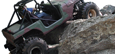
Kodak rock closed?

Or if needed I can also give you some stuff for you to hand out also. I need to order some more stuff from them also here this week so if you want I can also pick some up for you and give it to you at the workday or whenever you want.
 
I had talked with the gentleman over the tread lightly program about a year ago but things have not cooperated for me to go down to get my instructor training yet. At the time I was going to build my jeep but have opted to stay with the smaller ORVs.
 
I've transcribed the Trail Adoption Agreement and Adopt-A-Trail Guidelines for Uwharrie NF here. I'll also scan the hard copies and upload the files in that same thread.
 
I had talked with the gentleman over the tread lightly program about a year ago but things have not cooperated for me to go down to get my instructor training yet. At the time I was going to build my jeep but have opted to stay with the smaller ORVs.


As you already know most of it is common sense . I know there is going to be a full class here soon this year that a few Master Tread Trainers are going to give. If you want I can figure out the specifics and try to get you to attend it.
 
I would like to appologize for my pointing the finger at a certain user group. I meant no disrespect toward that user group. This is no way to try and work together to get our trail opened back up. We need to work together toward this goal and finger pointing is not going to help at all. I was being unprofessional at that time. I stepped back to take a breath and seen what it was doing for our cause.

I have gotten a few books in the mail to try and help us out from other clubs that have gone thru what we are going thru. I have sent some mail out myself also to certain places.

One of these books would be really good i think for our new Team Leader to read also. I think it will help us alot as volunteers if a bunch of us pass it around and read it.

Again i appologize.
 
We are forgetting one group of trail users as well, dirt bike riders. They are more than likely to go off trail than atv's from what I've seen.


Sent from my mobile Toyota base using Tapatalk
 
The left bypass on the first ledge of Daniel was a surprise to me.
Same damn surprise as the bypass on Dickie bell. (left of fence... you'll be amazed when you see it)
I remember when there was was only one way up Dickie bell, now the fence is gone in two spots, one below and one up top.

How about the legde on RML?
I could make it up with a spotter and 33's few years ago.
Does anyone remember the tree? The only true bypass and you had to finish basically half the obstacle to get by. There was NO Far Left bypass!
Same goes with kodak and budweiser. The left line was the 'easy' line. Now the 'easy' line is the one that hugs the guard rail.
And NOW there is a trail to the right of that, that bends in...!

Pay attention to what Dan Kelly said. Daniel used to be a moto trail-ONLY.
It is a simply fact. It is called popularity and traffic.
We all made this place famous and have waited in the snail and slug lines long enough. Some get impatient. Some don't understand wheelin.
Simple personal rules help, like - I refuse to go out with more than a half dozen rigs. Thats too many at URE

We are ALL to blame.
I do agree with the lack of oversight and 'policing' on the trail at URE.
That being said, I know for a fact, a year or so ago, without Officer Foote randomly walking down the ledge one day on Daniel, some SxS'er may have got their ass beat.....
So they do appear. Just not enough.
Anyhow.... you guys say there are cops/FS at Brown MT trails?? Well then what the fuck?
Why is the most popular offroad place in NC without a 4x4 or SxS FS/police to keep people informed and inline?

I pose this thought and I could be wrong.
But an ATV is a few hundred or a few grand.
A bike is the same, Right?
I bet money that the ATV and Moto crowd you see at URE are not 'online', on any 'forums', 'informed' and 'organized' like we 'think' we are.
I am willing to bet. Yes BET that they are weekend warriors who just want to ride.
SO the challenge is this:
How the FUCK are they supposed to know where to go and not go when the trails are EVERYWHERE?
I bet, that they don't know what the hell Tread Lightly is or S4WD or KoH or any damn thing we care about or aspire to be.
I could buy a bike right now, helmet and pads and not give a fuck. Drive to some trailhead in GA, TN, SC, VA and go home in a day!
Would I know that a STINK has been raised about past users/abusers about some particular area?
Heck NO.
I would go home happy that I rode and tell all my buddies about this cool spot I had fun at (a few times) last year.
How do we solve this?

Now.... I challenge everyone here with this..... now imagine that my story is not an ATV or a Moto. That these are us. Offroad rigs.
With the unfortunate advantage of being so damn close to an offroad park that happens to be a National Forest and damn near free.

Oh and my story about the guy with the ATV or Bike... He just sold it. He had enough fun and will never know what we are bitching about.
 
We ran into several rigs on Daniel yesterday that had to turn around, people who were unfamiliar with the trail and the difficulty. Several pointed at the illegal bypass (which we were blocking with the Jeep, to be out of the way), so we told them what was going on. I wonder if we need copies of Don's map to hand out, with the ratings, but also if there needs to be a sign at the first ledge that explains... if you can't make it up the first ledge, turn around.
 
Maybe a better more informative kiosk at the beginning of the trail that really catches your eye to tell you the rating of Daniel. Something that sticks out really bad. And tells these new people about Tread Lightly as we need help getting the word out more than most of us can be there. Maybe I / we can get some just Tread Lightly kiosks made up and put at all trail beginnings. These would go along beside the FS ones. Just a thought.
 
Trail rating - agreed. Good idea.
Winches and lockers recommended.

Tread lightly signs at start of trail - won't help.

Like I said before (albeit long winded) How do you define a "bypass"?
If it looks like a trail.... someone is going to ride it.
You need a sign at the illegal bypass basically stating that this is off trail. Not only visible but blocking the bypass.
Can we find out from the FS what kind of signs are allowed and can we put them there?
I am asking honestly because the roadblock that was put up on a work weekend a year ago at the Z-turn had to be removed. The FS has some odd rules to follow.
 
Maybe a better more informative kiosk at the beginning of the trail that really catches your eye to tell you the rating of Daniel. Something that sticks out really bad. And tells these new people about Tread Lightly as we need help getting the word out more than most of us can be there. Maybe I / we can get some just Tread Lightly kiosks made up and put at all trail beginnings. These would go along beside the FS ones. Just a thought.

Wouldn't hurt to put a map of Daniel with all the obstacles marked on it at the kiosk as well.
 
Tread lightly signs at start of trail - won't help.

quote]

Why do you think it will not help ? If people do not know about this stuff then if we do not teach them how will they learn ? I guess the best place is on the top of a Bud Light can . I have come across a bunch of people that i gave them a short talk to about Tread Lightly and they had no clue. It can not hurt .
 
Trail rating - agreed. Good idea.
Winches and lockers recommended.

No, it's simpler than that. If you can't drive the first ledge, you need to turn around and go back to the parking lot. Lockers nor winches are "required" to run Daniel. A lot of people seem to think so, though. Then they pull up on the ledge with 35psi in the tires and give it hell.
 
Agreed Shawn. I have led up open/open troopers on pizza cutters. It can be done, you are right.

My previous comment about the Tread Lightly sign at the start of the trail, kryzabncanuck quoted, should have been more explicit. Putting a sign where you need a sign makes more sense.
Like "Don't Drive Here. This is not a bypass - $x000 Fine for removal of sign or trespass on bypass"
Which is different than a general Tread Lightly sign at the entrances of the trail.
I think both can help. Need to coordinate with FS on what is allowed.
Chris (snappy) who else here is talking to Terry or Debra?
Who should we be listening to for results?
 
The orange diamonds mark the trail, anyone with any sense should know that no marker = no trail... But we've already established that common sense isn't so common any more.
 
The markers are inconsistent or in some places, non-existent.

I know I've been confused about where the "real" trail is and didn't see any markers, so I just had to make an uneducated guess.
 
Jason might have said it in another thread but I think marking trails with downed trees would be a good fix. We'd only need to do it in some areas, his analogy was like a gokart track. Then go and put up the diamonds. Which I think the diamonds should be color coded to the trail, that way you can know which trail you are on by the color of the diamond. Also thing there should be larger markers where two trails meet.


Sent from my mobile Toyota base using Tapatalk
 
We tried the big tree route ignorant jackasses don't care !
 
Agreed Shawn. I have led up open/open troopers on pizza cutters. It can be done, you are right.

My previous comment about the Tread Lightly sign at the start of the trail, kryzabncanuck quoted, should have been more explicit. Putting a sign where you need a sign makes more sense.
Like "Don't Drive Here. This is not a bypass - $x000 Fine for removal of sign or trespass on bypass"
Which is different than a general Tread Lightly sign at the entrances of the trail.
I think both can help. Need to coordinate with FS on what is allowed.
Chris (snappy) who else here is talking to Terry or Debra?
Who should we be listening to for results?


Both Chris and I are working on this thing with Terry / the USFS. Chris is going one way and I am going down a different street. Guess one of these days maybe we should put out what all we are doing in the background not being seen by all on here. I will wait till after this meeting tonight to see if that is a good idea though.
 
Which I think the diamonds should be color coded to the trail, that way you can know which trail you are on by the color of the diamond.

Lots and lots of the diamonds have the trail numbers written on them.
 
You've got a map (or you should, in which case that's really the problem here). If you're on Dutch John and you get to the end, that's Slab Pile. Go left for Saw Mill, right for RML. It's not rocket surgery.

Edit: And most of the trails have a post at each end that announces the trail name and who the sponsor club is. But a lot of these were stolen.
 
True but over half the ones I see and ones near intersections are either gone or blank.


Sent from my mobile Toyota base using Tapatalk


We try to mark the trails every year but that is not all clubs get to it every year. I and my wife marked Wolf den last year right around the end of the year but some of those are probably in need of remarking. The markings only last about 6 months in the sun. I even talked to a guy about getting some gone professionally but he said they would only last maybe a year and at 2 bucks a pop I was looking at over 200 bucks for maybe a year and that is too much for a retired guy to stomach. That was just for our clubs trail.
 
You've got a map (or you should, in which case that's really the problem here). If you're on Dutch John and you get to the end, that's Slab Pile. Go left for Saw Mill, right for RML. It's not rocket surgery.

Edit: And most of the trails have a post at each end that announces the trail name and who the sponsor club is. But a lot of these were stolen.


Each trail still has the little carsonites on them at the beginning or at least did the other weekend before the trails opened up for the year. Except I think Daniel did not have one still as everyone likes to steal it.
 
You've got a map (or you should, in which case that's really the problem here). If you're on Dutch John and you get to the end, that's Slab Pile. Go left for Saw Mill, right for RML. It's not rocket surgery.

Edit: And most of the trails have a post at each end that announces the trail name and who the sponsor club is. But a lot of these were stolen.

I always have a map, rarely needed now. I'm mainly saying for new people and others who some how get lost. I just brought it up as idea. The more marking we have of where the trail actually is, it might help some of the going off trails.


Sent from my mobile Toyota base using Tapatalk
 
Back
Top